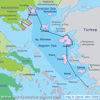
Red line = our route
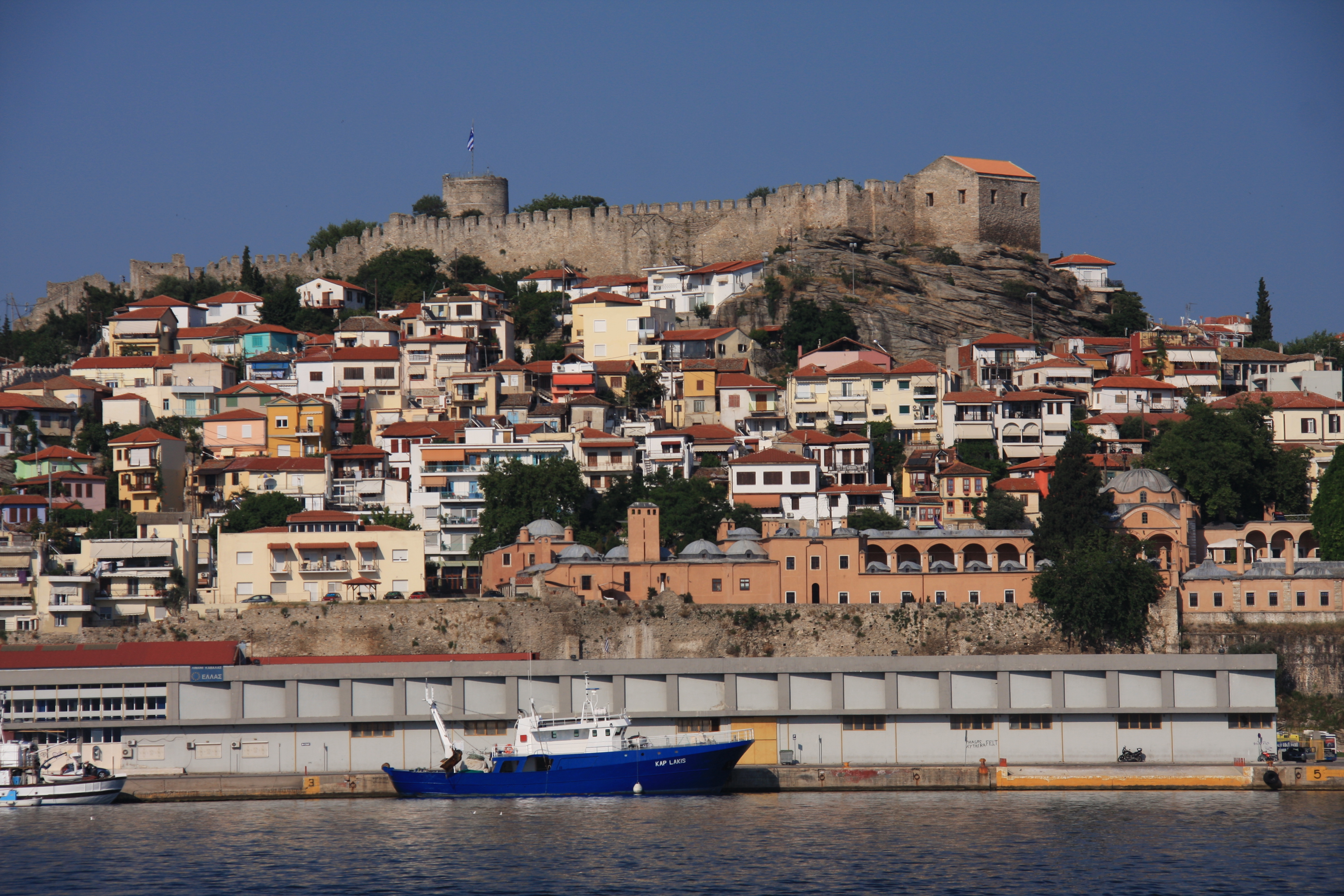
Leaving the northernmost Aegean island of Thassos, we headed across to the Greek mainland for an unplanned brief stop (minor engine issues) to Kavala with its aqueduct running through the middle of town and the Turkish fort on the hill.

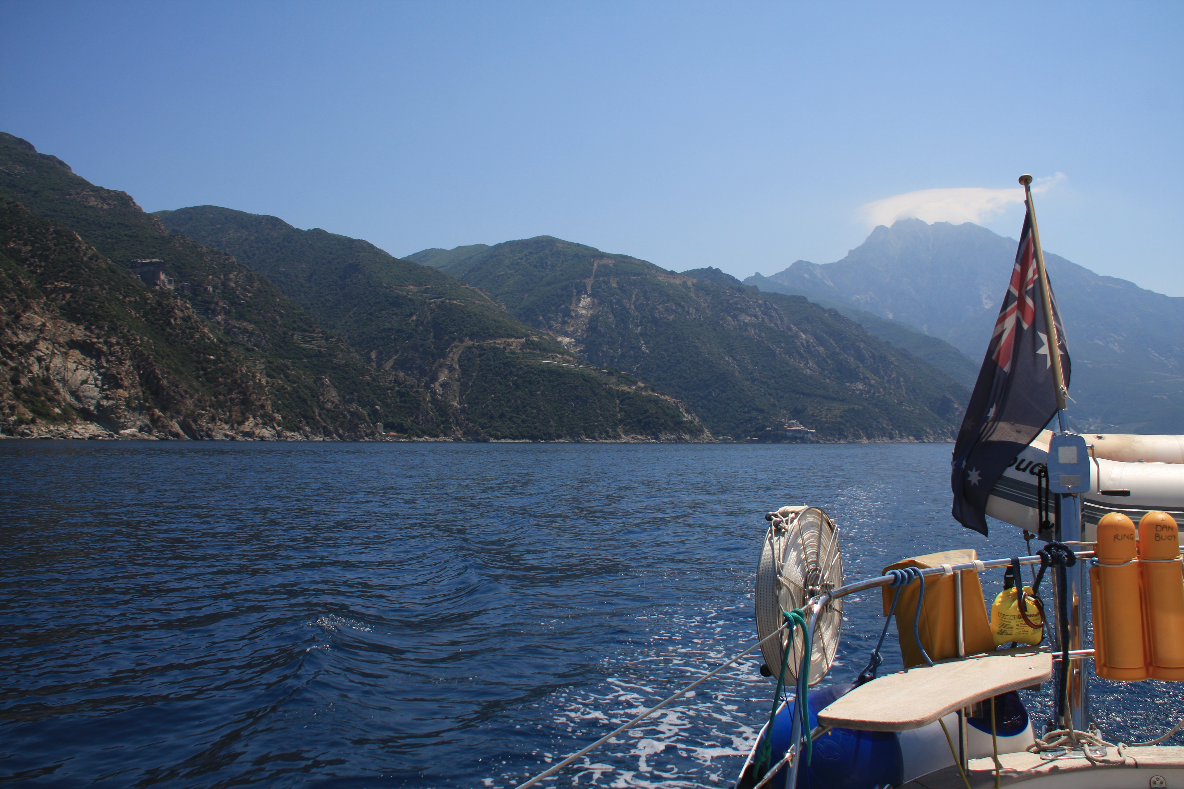
We were very much looking forward to rounding the Athos peninsula soon, having heard a lot about its spectacular monasteries. Skala Marion on Thassos was a good overnight, calm weather only anchorage with spectacular sunset – an ideal jumping off point early the following morning for a 60Nm day west to the Athos to catch it in daylight. This was one day we were glad to have no wind and glassy seas, as the tip of the peninsula is notorious for its turbulent seas and currents onto this lee shore in any wind.

One’s first view of the coastline is spectacular Mt Athos (higher than Koscziusko) with a wisp of cloud hanging off the peak.

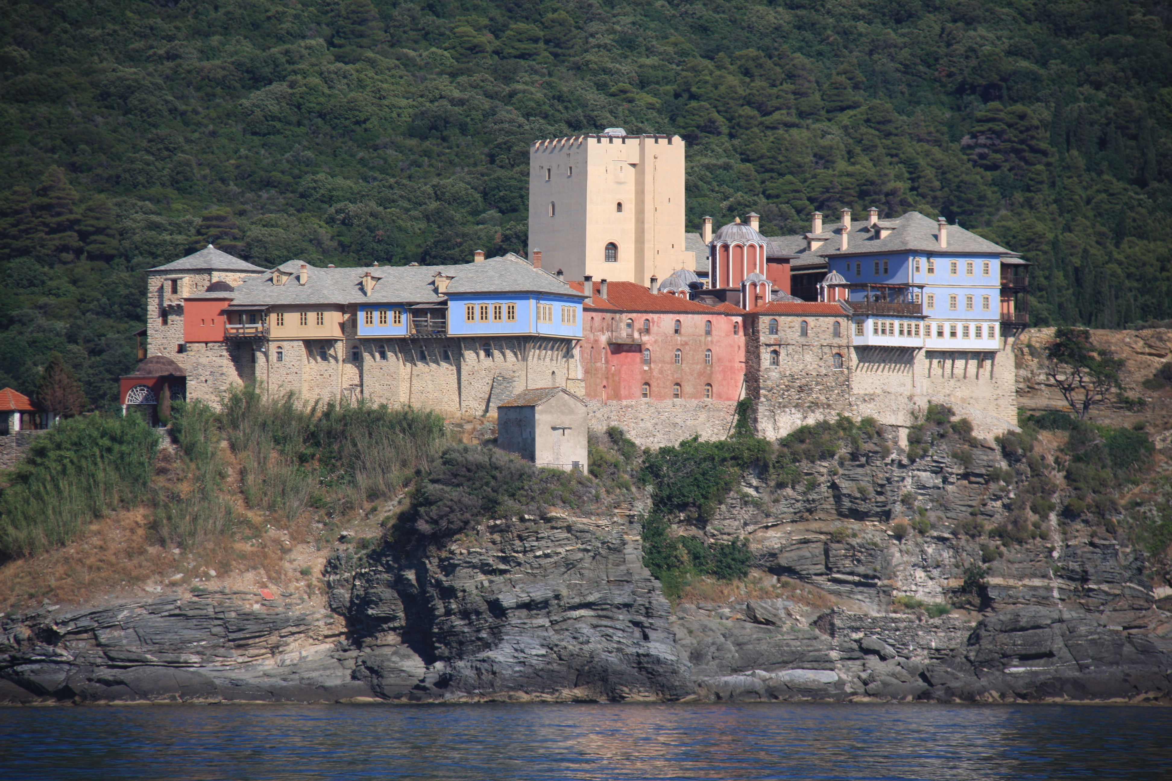
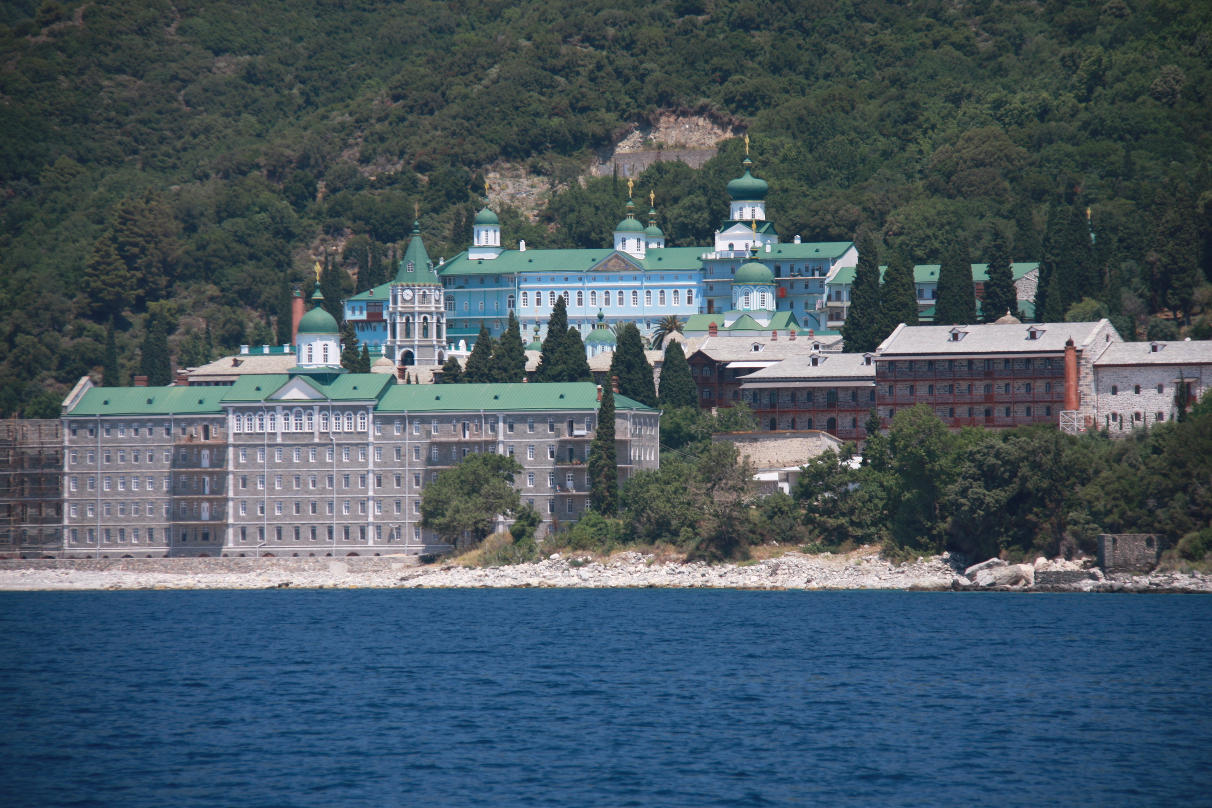
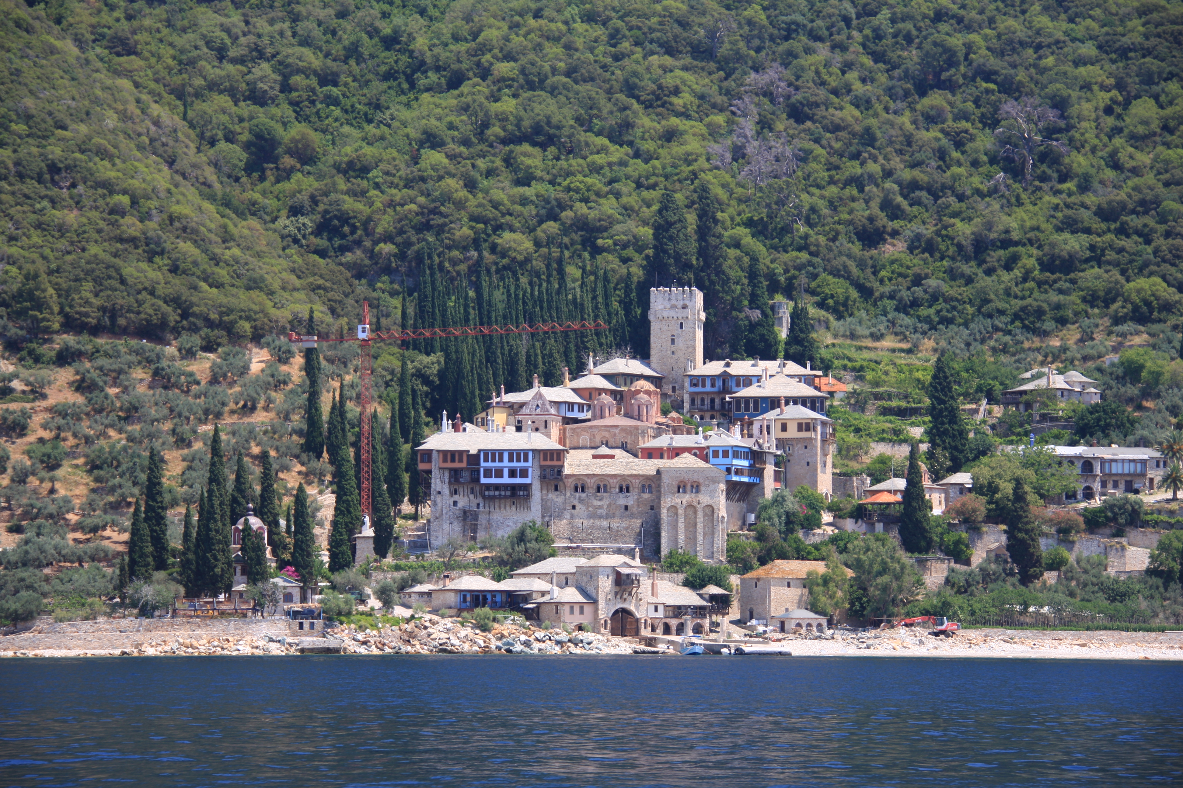
The Agio Oros peninsula, with Mt Athos at its southern tip, is home to about 20 large monasteries, currently inhabited by 1,450 monks. The first monastery was established in the 9th Century and since the 10th Century, the peninsula been an Orthodox monastic republic. While most of the monasteries are Greek, Orthodox monks from many places in northern Europe and as far away as Argentina, have built very imposing monasteries in this very isolated place. The peninsula is closed to land visitors and strictly forbidden for women. It is only possible to visit the peninsula by land with special permission if one has religious or academic affiliations. Until recently, not only were women prohibited, but also female animals and even clean- faced men!
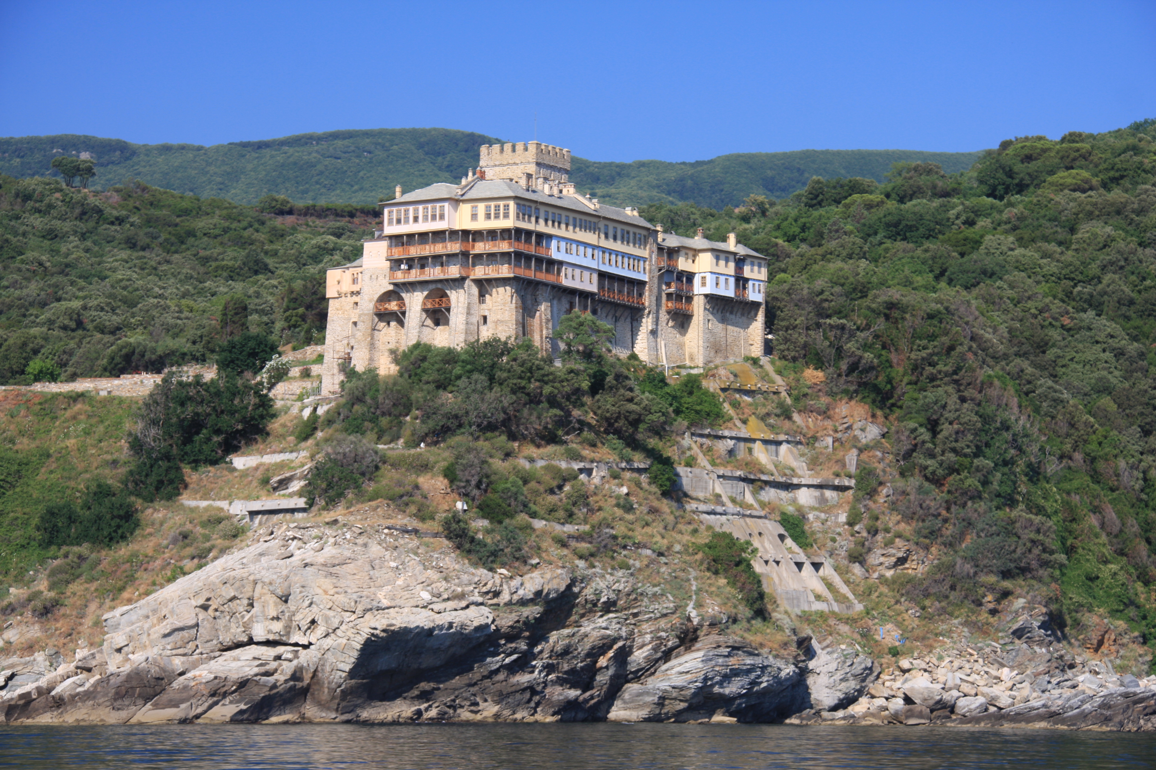
The monasteries on the eastern side are very grand, with most lying quite close to the water. As well as the large monasteries, there are a few larger houses & little villages with churches tucked into lush green, steep countryside.


As you can imagine the maintenance of these imposing structures is constant and ongoing. The huge cost of this is borne by income of the large and valuable properties held elsewhere by the church itself as well as EU and UNESCO funds. A number of the monasteries are foreign owned.
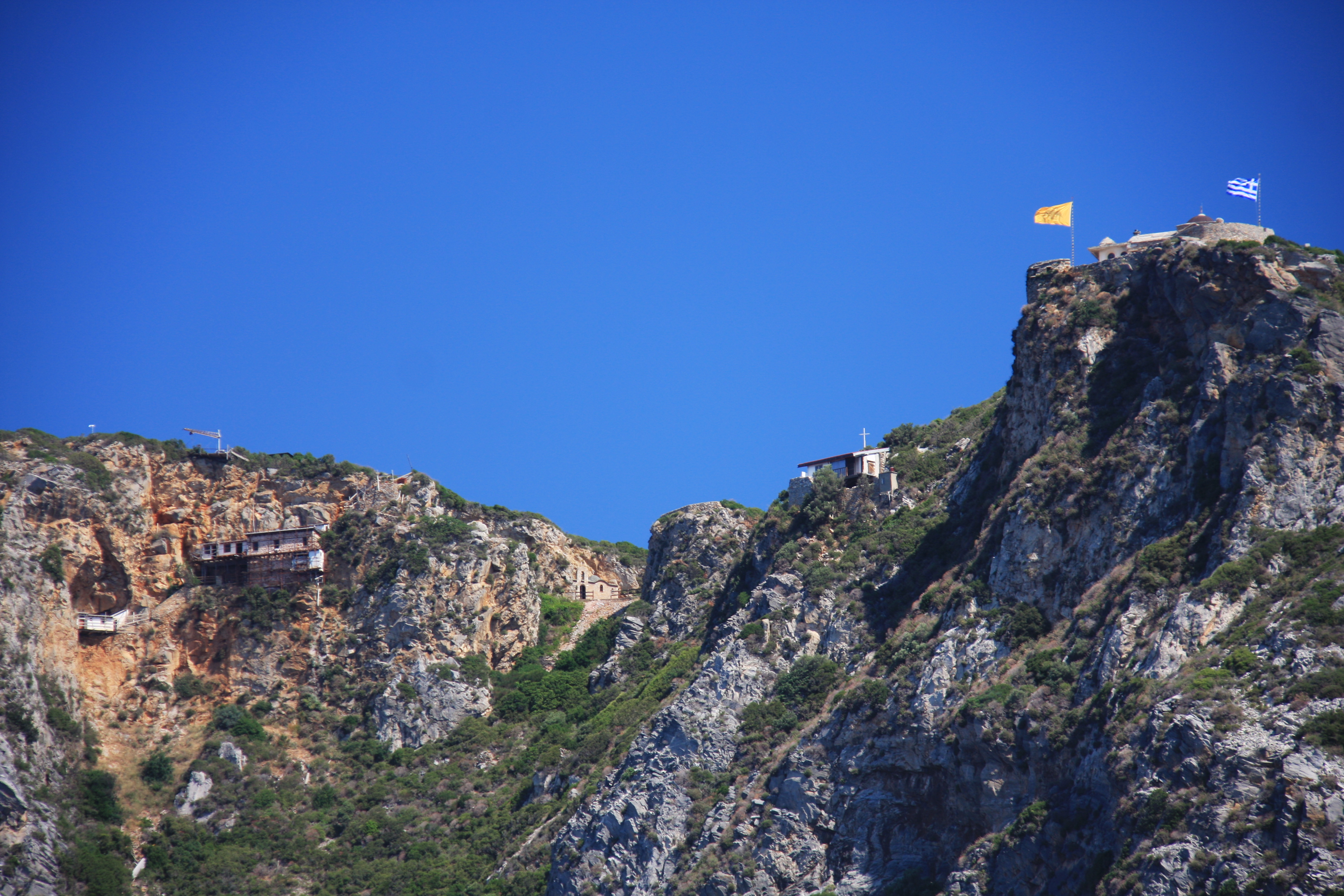
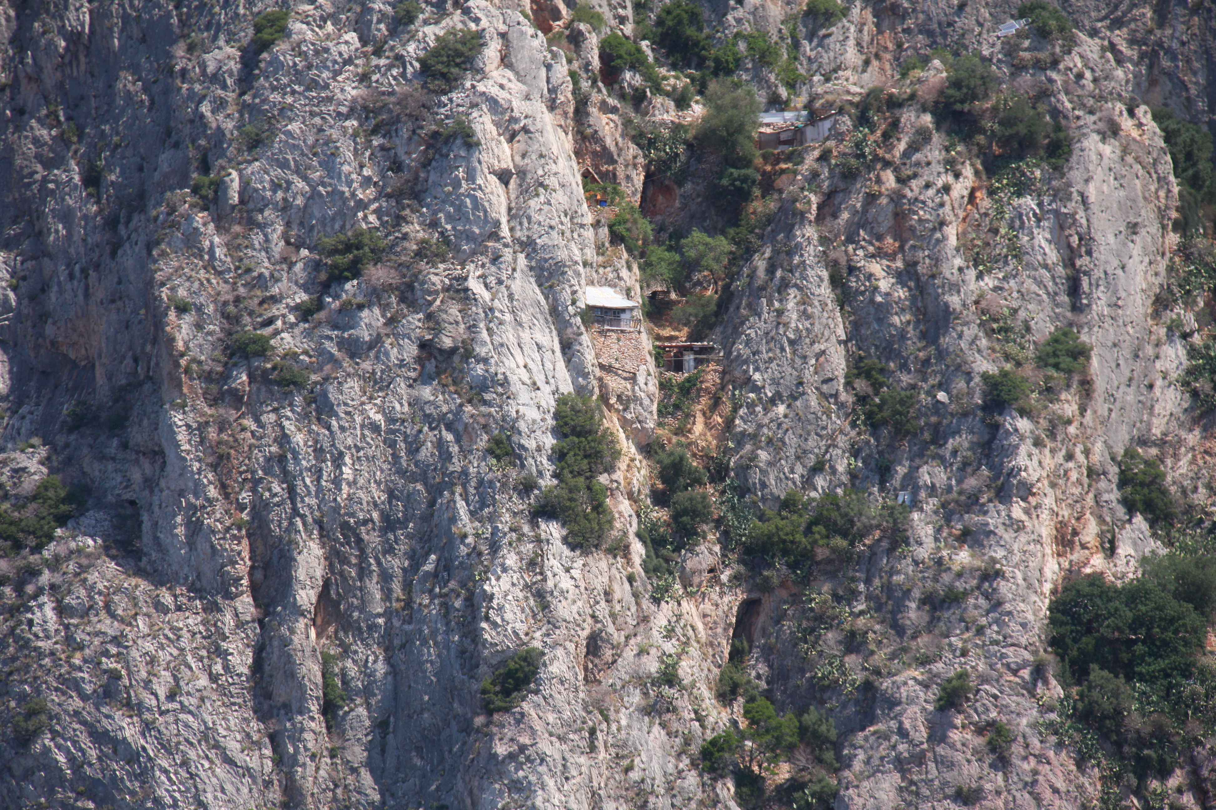
The southern coastline, the most inaccessible part of the peninsula has a large number of small dwellings, many little more than shacks (presumably housing hermits) in the most unimaginably inaccessible places tucked into small holes in steep rock faces! Although there were some small landing jetties, most of the buildings were perched on the rugged cliff faces high above the sea, with no way to easily access the sites visible with very few roads on the peninsula. We wondered how they get provisions, let alone build and renovate here.

On the western side is the only significant port of the peninsula. In the flatter areas, vineyards and hot houses are evident. Also visible were cars, cement trucks, solar panels ++ the trappings of modern life. In the 70’s there were no roads nor electricity.
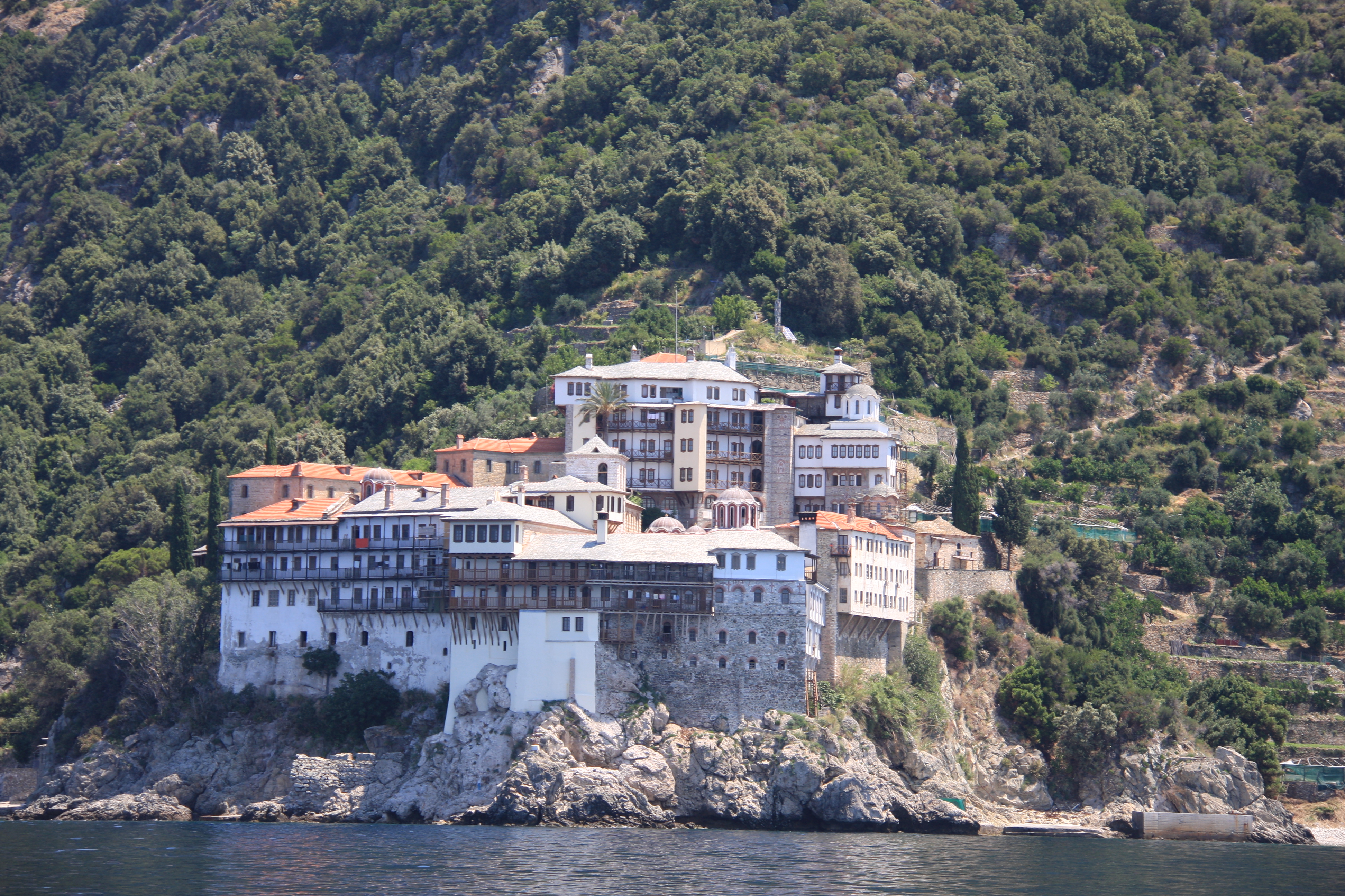
The largest of the monasteries on the West side is Russian covering more land than most small towns!
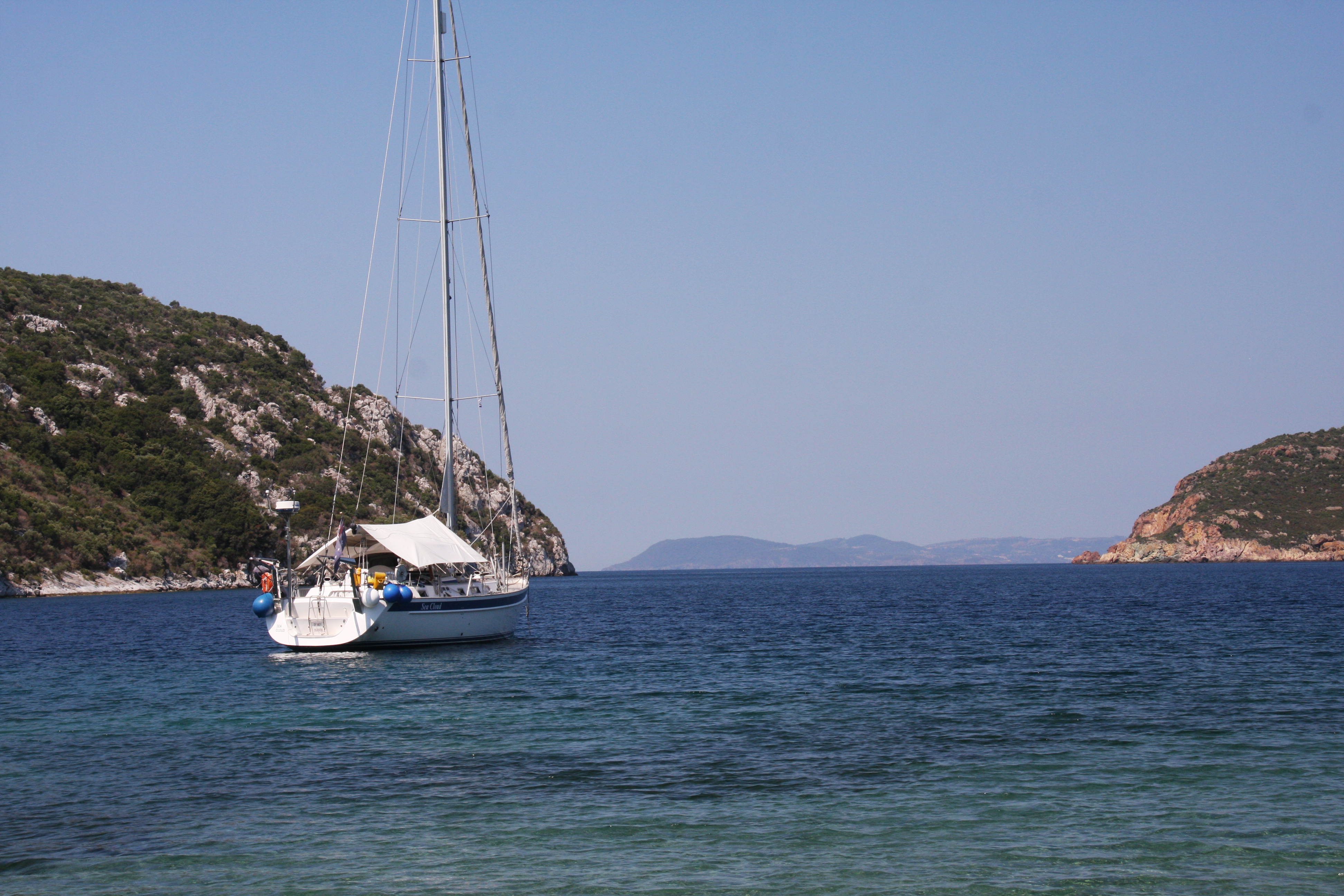
Along the entire 50Nm of this coastline we saw only one other yacht. A couple of tripper boats access the very northern monasteries from the mainland. It certainly was a wonderful day – 65 miles which seemed to go in a flash.
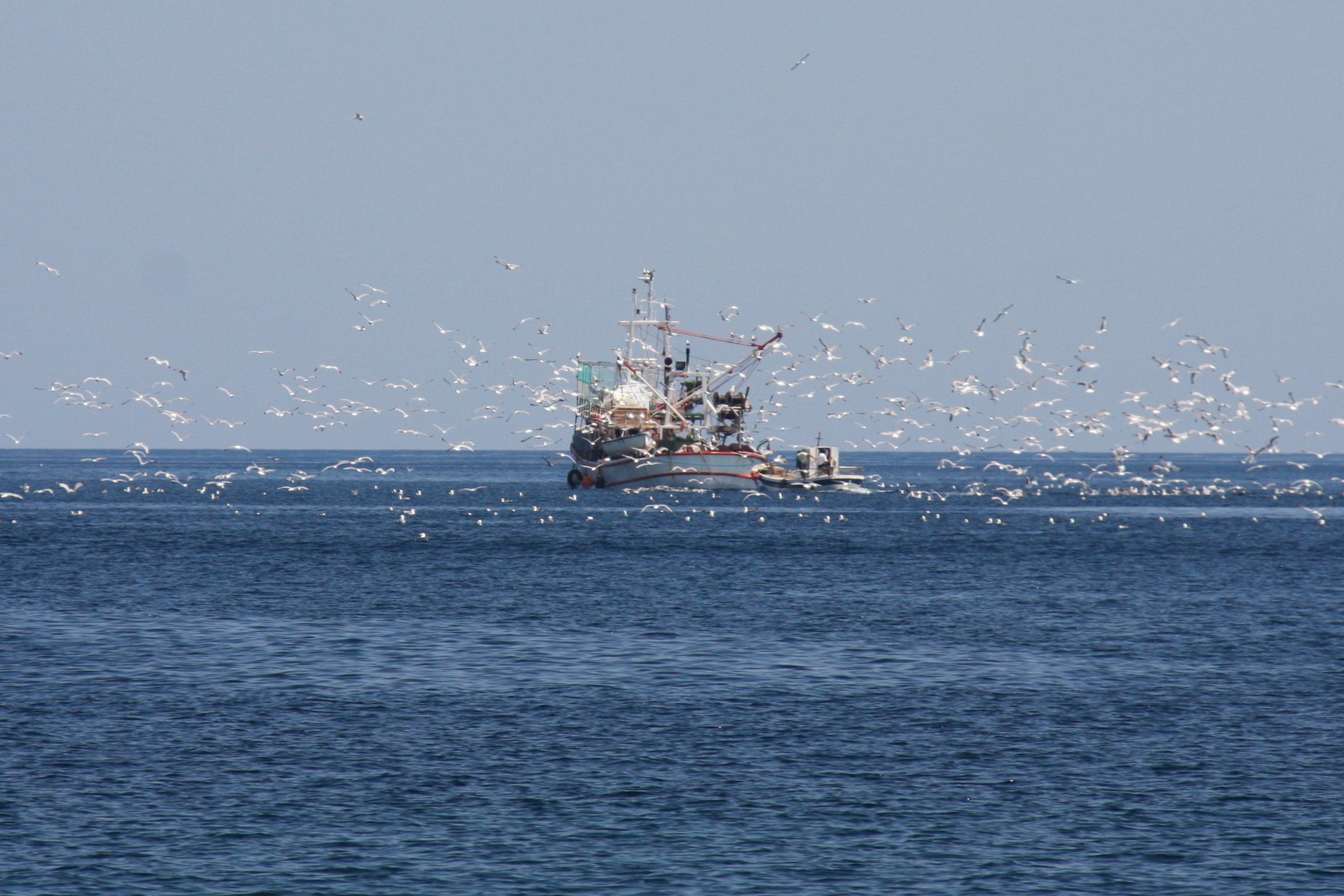
As yachts can’t anchor on the peninsula, we dropped anchor under Ammouliani island, in a bay with beautiful white sand and turquoise water, but unfortunately, a rather noisy beach and equally noisy seagulls swamping an obviously successful fishing boat!

Obviously the fishing is really good in this gulf, I have never seen so many birds around a fishing boat!
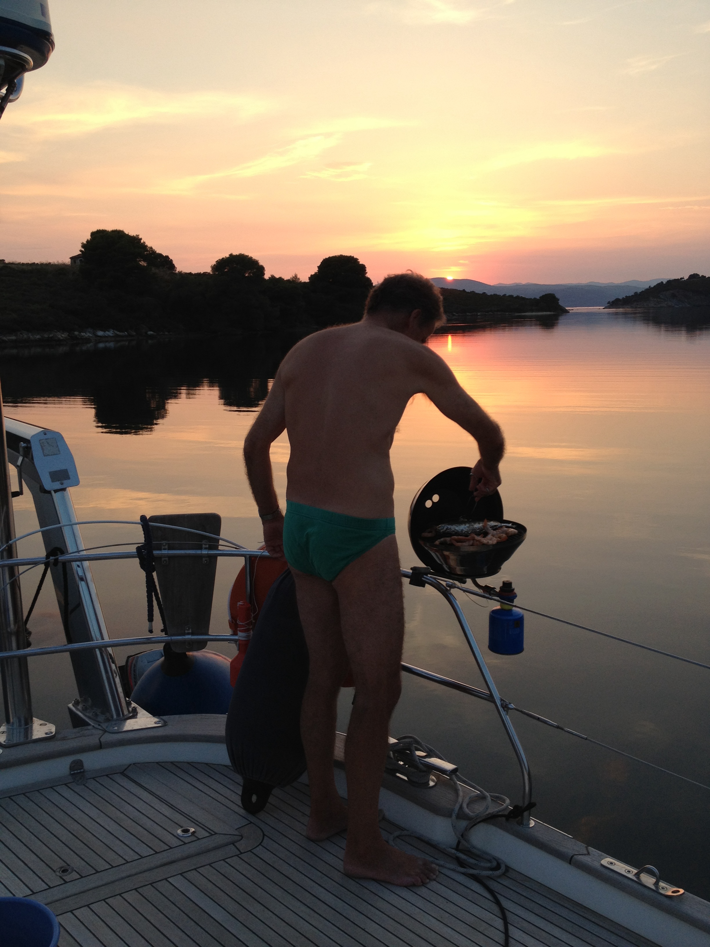
The small town of Panagia on the eastern shore of the Sithonia Peninsula was a very pleasant spot. To Ian’s delight we found plentiful fresh fish and prawns for the barbie from the local fish cooperative. Although fish is always on the menu in Greek restaurants, it is always too expensive.

A night in Kriftos bay at anchor – the only boat in the bay, fresh fish and prawns on the BBQ – who needs to dress for dinner?!
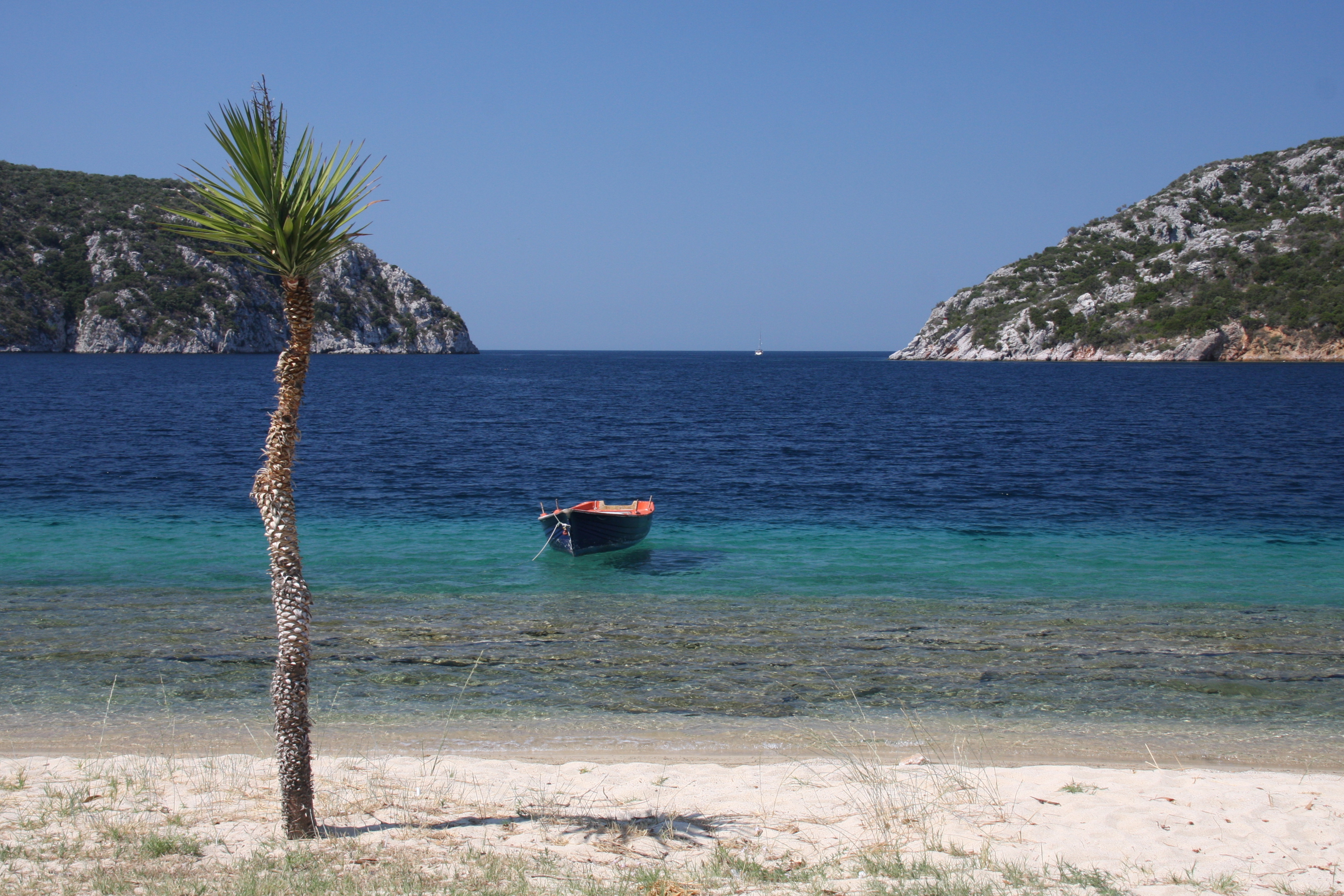
The water around Diaphoros Island is the most beautiful turquoise colour, wonderful for exploring in the ducky.
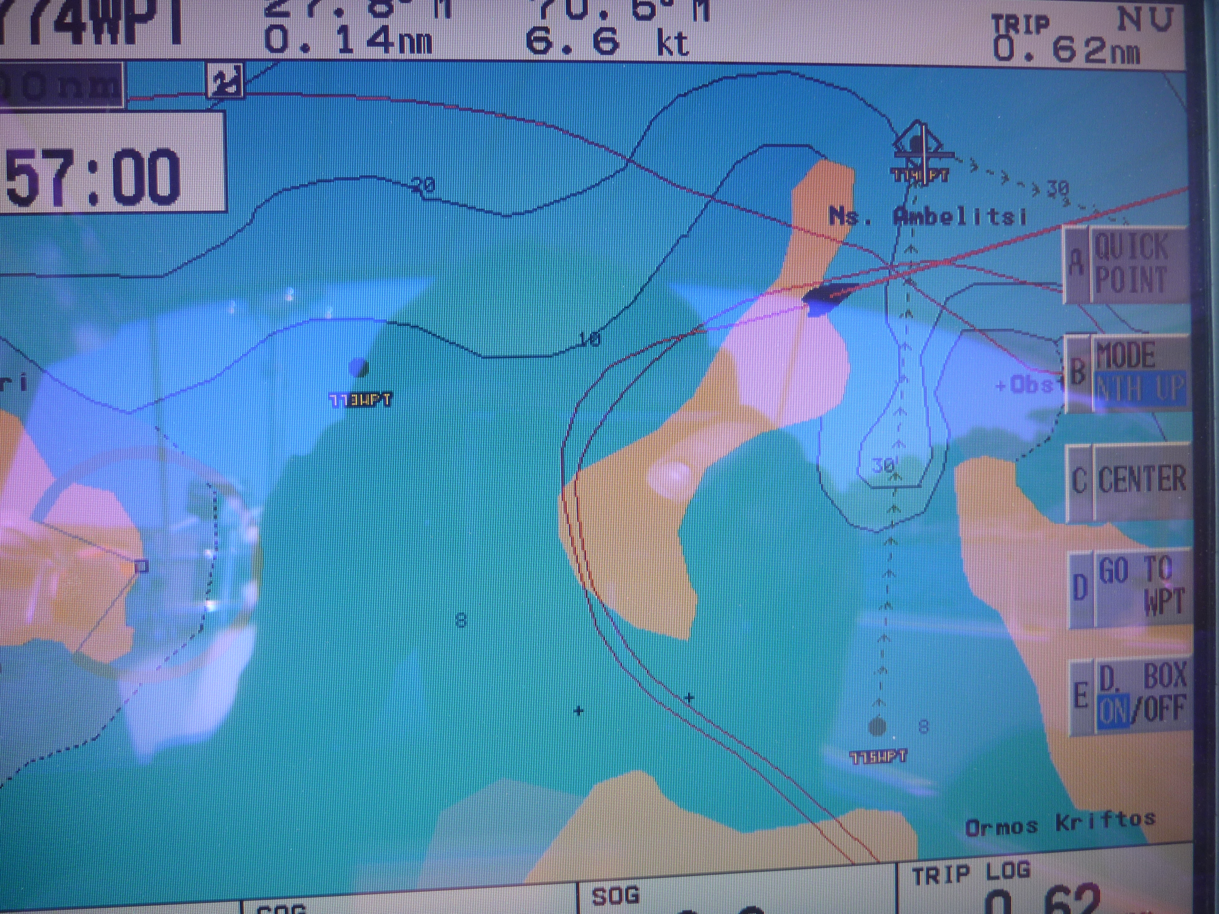
With the sun overhead and perfectly clear water through the narrow channel it was a timely reminder never to trust the GPS plotter for pilotage in tight spots. The C-MAP chart was 360m in error (see our tracks over the land), while the iPad Navionics was much more accurate.
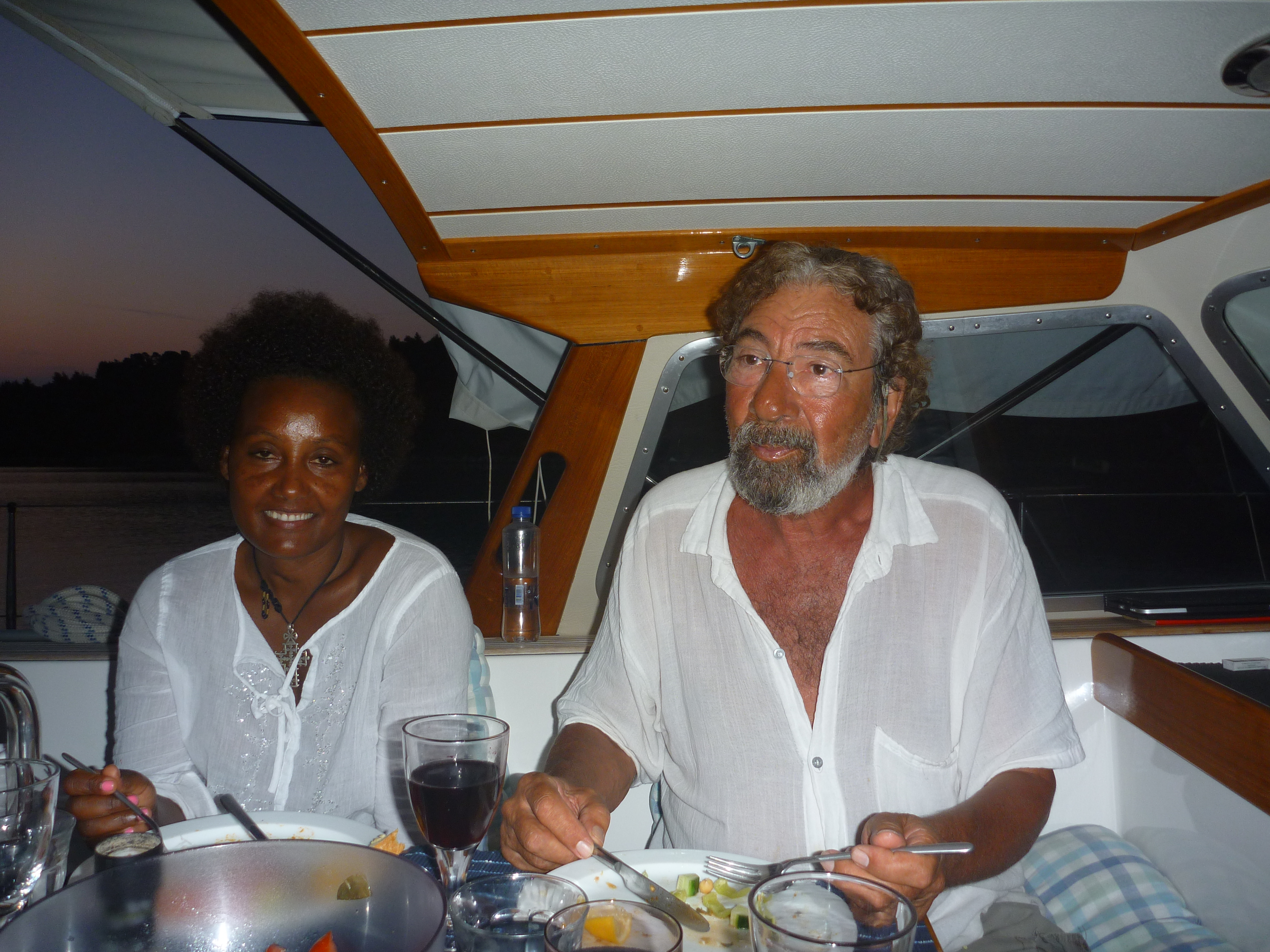
Jorge and Zoufan, who we’d met in Molivos (Lesvos Is) and again in Limnos dropped anchor in the bay next to us. Jorge, who is Greek told us many humorous stories of his 3 months hiking as an 18 yr old between monasteries on Athos in the 1960s. He had spent 3 months there as an 18 year old as a ‘journalist’ doing a story on the monasteries. He spoke of the long distances walking between the monasteries worrying about wolves and bears and the need to be in by 7pm or the doors would be locked. As a young man, it was not always safer indoors either…!
The coastline further south on the Sithonia peninsula is very beautiful, with forests down to the edge of the white sandy beaches. It is also very popular, fortunately many places have camping sites rather than built development along the shores. More dolphins!

Porto Kuofo a beautiful harbour on the western tip of the Sithonia peninsula, was our last stop before heading to the Northern Sporades. Although it is a large land locked natural harbour, it is also a tricky anchorage as it is very deep at one end and has a huge shallow spit in the middle of the bay.
Here we had encountered our first charter flotilla for the season. It must have been the first time out for this flotilla leader, as 4 of the 10 boats managed to ground themselves on the sandbar in the middle of the bay! Seeing so many boats was a bit of a surprise but a reminder that low season is almost over. This area has been fantastic for cruising this time of the year. Some days we only saw one or 2 other boats and had many nights alone in bays.

Wow what an adventure!